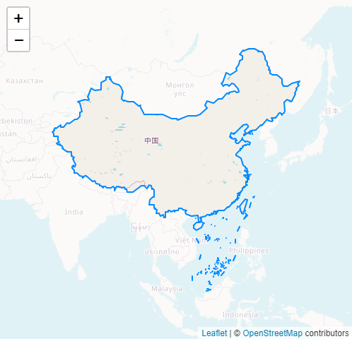
Leaflet.Mask is a Leaflet plugin that loading polygons from geojson to masking the rest of the map.
Check out the demo .
var map = L . map ( "map" , {
center : [ 29 , 120 ] ,
zoom : 8
} ) ;
L . tileLayer ( 'https://{s}.tile.openstreetmap.org/{z}/{x}/{y}.png' , {
attribution : '© <a href="https://www.openstreetmap.org/copyright">OpenStreetMap</a> contributors'
} ) . addTo ( map ) ;
L . mask ( 'bound.json' , { } ) . addTo ( map ) ; L . mask ( geosjon , options ?)
Parameter
Type
Description
geosjon
String|Object
.geojson URL or GeoJSON object
options
Object
Layer options
Option
Type
Default
Description
interactive
Boolean
false
If false, the mask layer will not emit mouse events and will act as a part of the underlying map.
fitBounds
Boolean
true
If true, the map fits the maximum zoom level to the given geographical bounds.
restrictBounds
Boolean
true
If true, the map restricts the view to the given geographical bounds, bouncing the user back if the user tries to pan outside the view.
Options inherited from L.Path
Option
Type
Default
Description
stroke
Boolean
true
Whether to draw stroke along the path. Set it to false to disable borders on polygons or circles.
color
String
'#3388ff'
Stroke color
weight
Number
2
Stroke width in pixels
opacity
Number
1.0
Stroke opacity
lineCap
String
'round'
A string that defines shape to be used at the end of the stroke.
lineJoin
String
'round'
A string that defines shape to be used at the corners of the stroke.
dashArray
String
null
A string that defines the stroke dash pattern. Doesn't work on Canvas-powered layers in some old browsers.
dashOffset
String
null
A string that defines the distance into the dash pattern to start the dash. Doesn't work on Canvas-powered layers in some old browsers.
fill
Boolean
depends
Whether to fill the path with color. Set it to false to disable filling on polygons or circles.
fillColor
String
'#FFFFFF'
Fill color.
fillOpacity
Number
1.0
Fill opacity.
fillRule
String
'evenodd'
A string that defines how the inside of a shape is determined.